
Scheduled Maintenance
This website will undergo scheduled maintenance on Tuesday, September 10th, between 11:00 and 15:00, as well as on Thursday, September 12th, between 10:00 and 12:00. During this time, services may be temporarily disrupted. We apologise for any inconvenience.
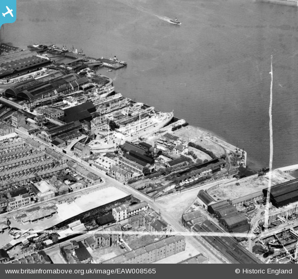
EAW008565 ENGLAND (1947). Clover's Graving Docks, Birkenhead, 1947. This image was marked by Aerofilms Ltd for photo editing.
© Copyright OpenStreetMap contributors and licensed by the OpenStreetMap Foundation. 2024. Cartography is licensed as CC BY-SA.
Nearby Images (33)
EAW008565

EAW008657

EAW008663

EAW008658

EAW008560

EAW008719

EAW000410

EAW008564

EAW008660

EAW000415

EAW008661

EAW008665

EAW008563

EAW000416

EAW003746

EAW008662

EAW008718

EAW008666

EAW008561

EAW008664

EAW000411

EAW003741

EAW008659

EAW003742

EAW008562

EAW001719

EAW000413

EAW003744

EAW000414

EAW003745

EAW003740

EAW000412

EAW001807

Details
| Title | [EAW008565] Clover's Graving Docks, Birkenhead, 1947. This image was marked by Aerofilms Ltd for photo editing. |
| Reference | EAW008565 |
| Date | 27-July-1947 |
| Link | |
| Place name | BIRKENHEAD |
| Parish | |
| District | |
| Country | ENGLAND |
| Easting / Northing | 332966, 388901 |
| Longitude / Latitude | -3.0081375717352, 53.392421089112 |
| National Grid Reference | SJ330889 |
Pins
 BobH |
Wednesday 17th of June 2020 12:44:41 PM |