
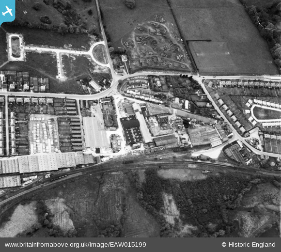
EAW015199 ENGLAND (1948). The Rippers Ltd Joinery Works on Station Road and environs, Sible Hedingham, 1948
© Copyright OpenStreetMap contributors and licensed by the OpenStreetMap Foundation. 2024. Cartography is licensed as CC BY-SA.
Nearby Images (18)
EAW015199

EPW025970

EPW025968

EPW025971

EPW025973

EAW015198

EAW015189

EAW015190

EPW025965

EPW025972

EPW025969

EAW015192

EPW025963

EPW025975

EPW025967

EAW015196

EPW025974

EAW015197

Details
| Title | [EAW015199] The Rippers Ltd Joinery Works on Station Road and environs, Sible Hedingham, 1948 |
| Reference | EAW015199 |
| Date | 5-May-1948 |
| Link | |
| Place name | SIBLE HEDINGHAM |
| Parish | SIBLE HEDINGHAM |
| District | |
| Country | ENGLAND |
| Easting / Northing | 578077, 234581 |
| Longitude / Latitude | 0.59330959767161, 51.980680601106 |
| National Grid Reference | TL781346 |
Pins
Be the first to add a comment to this image!