
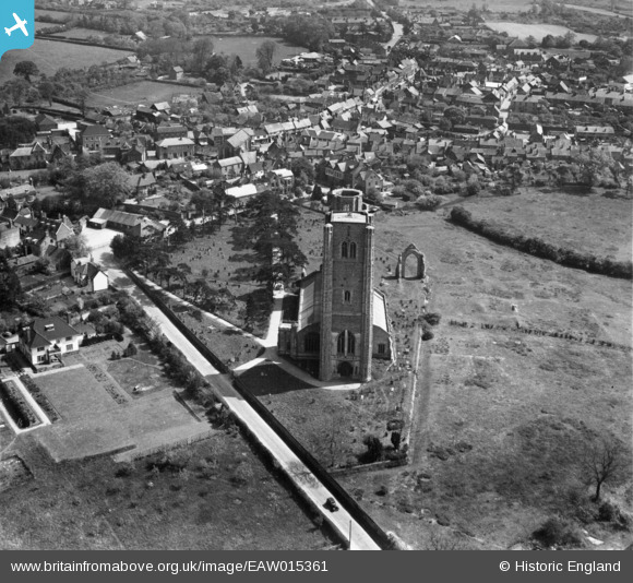
EAW015361 ENGLAND (1948). The Abbey Church of St Mary and St Thomas of Canterbury, Wymondham, 1948
© Copyright OpenStreetMap contributors and licensed by the OpenStreetMap Foundation. 2024. Cartography is licensed as CC BY-SA.
Nearby Images (3)
EAW015361

EPW039242

EAW015362

Details
| Title | [EAW015361] The Abbey Church of St Mary and St Thomas of Canterbury, Wymondham, 1948 |
| Reference | EAW015361 |
| Date | 7-May-1948 |
| Link | |
| Place name | WYMONDHAM |
| Parish | WYMONDHAM |
| District | |
| Country | ENGLAND |
| Easting / Northing | 610701, 301503 |
| Longitude / Latitude | 1.1095263441202, 52.570112113253 |
| National Grid Reference | TG107015 |
