
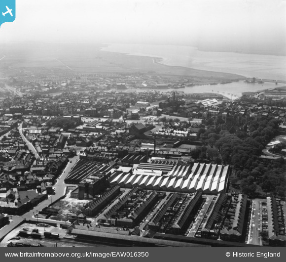
EAW016350 ENGLAND (1948). The Grout and Co Ltd Textile Factory and environs, Great Yarmouth, from the north-east, 1948. This image has been produced from a print.
© Copyright OpenStreetMap contributors and licensed by the OpenStreetMap Foundation. 2024. Cartography is licensed as CC BY-SA.
Nearby Images (28)
EAW016350

EAW016344

EPW021188

EAW016347

EAW016380

EAW016343

EAW052971

EAW052963

EPW008057

EPW008059

EPW008055

EPW008056

EPW008058

EAW052967

EAW052965

EAW052966

EAW052964

EAW052968

EAW052969

EAW052970

EAW016345

EAW016346

EAW016348

EAW016353

EAW016351

EAW016352

EAW016349

EAW016342

Details
| Title | [EAW016350] The Grout and Co Ltd Textile Factory and environs, Great Yarmouth, from the north-east, 1948. This image has been produced from a print. |
| Reference | EAW016350 |
| Date | 8-June-1948 |
| Link | |
| Place name | GREAT YARMOUTH |
| Parish | |
| District | |
| Country | ENGLAND |
| Easting / Northing | 652741, 307986 |
| Longitude / Latitude | 1.7335884410867, 52.610377434923 |
| National Grid Reference | TG527080 |
Pins
 redmist |
Tuesday 18th of January 2022 07:48:05 PM | |
 Matt Aldred edob.mattaldred.com |
Sunday 27th of December 2020 03:04:19 PM | |
Dean Duneclift |
Monday 9th of January 2017 11:33:52 AM | |
Dean Duneclift |
Monday 9th of January 2017 11:30:36 AM |