
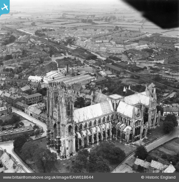
EAW018644 ENGLAND (1948). The Minster and environs, Beverley, 1948. This image has been produced from a print.
© Copyright OpenStreetMap contributors and licensed by the OpenStreetMap Foundation. 2024. Cartography is licensed as CC BY-SA.
Nearby Images (30)
EAW018644

EAW018619

EAW018621

EAW018618

EAW018622

EAW018623

EAW018624

EAW004523

EAW035017

EAW004518

EAW018616

EAW004524

EAW018620

EAW018625

EPW023166

EAW018617

EAW035018

EPW012710

EPW023168

EPW012711

EAW035019

EPW023161

EPW023167

EAW004519

EAW004520

EPW023169

EPW023165

EPW023164

EPW023162

EAW004517

Details
| Title | [EAW018644] The Minster and environs, Beverley, 1948. This image has been produced from a print. |
| Reference | EAW018644 |
| Date | 10-September-1948 |
| Link | |
| Place name | BEVERLEY |
| Parish | BEVERLEY |
| District | |
| Country | ENGLAND |
| Easting / Northing | 503756, 439408 |
| Longitude / Latitude | -0.42295152552337, 53.840334156628 |
| National Grid Reference | TA038394 |
Pins
 John Wass |
Wednesday 26th of October 2016 04:42:22 PM |