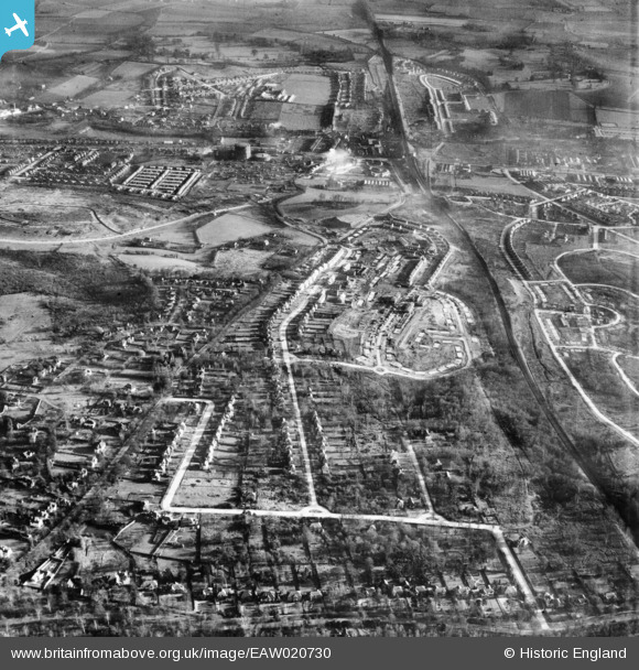
EAW020730 ENGLAND (1948). New housing development around Ravensbury Road, St Paul's Cray, 1948
© Copyright OpenStreetMap contributors and licensed by the OpenStreetMap Foundation. 2024. Cartography is licensed as CC BY-SA.
Nearby Images (12)
EAW020730

EAW042062

EAW042064

EAW042061

EAW021760

EAW020737

EAW020736

EAW020739

EAW026815

EAW026809

EAW020733

EAW020738

Details
| Title | [EAW020730] New housing development around Ravensbury Road, St Paul's Cray, 1948 |
| Reference | EAW020730 |
| Date | 24-December-1948 |
| Link | |
| Place name | ST PAUL'S CRAY |
| Parish | |
| District | |
| Country | ENGLAND |
| Easting / Northing | 546004, 168588 |
| Longitude / Latitude | 0.098996445186236, 51.397017537139 |
| National Grid Reference | TQ460686 |
Pins
 Karismat |
Monday 7th of March 2022 03:52:38 PM | |
Gone2Kent |
Sunday 13th of April 2014 08:09:07 PM | |
Gone2Kent |
Thursday 26th of December 2013 09:14:39 PM | |
Gone2Kent |
Thursday 26th of December 2013 09:12:33 PM | |
Gone2Kent |
Thursday 26th of December 2013 09:10:41 PM |