
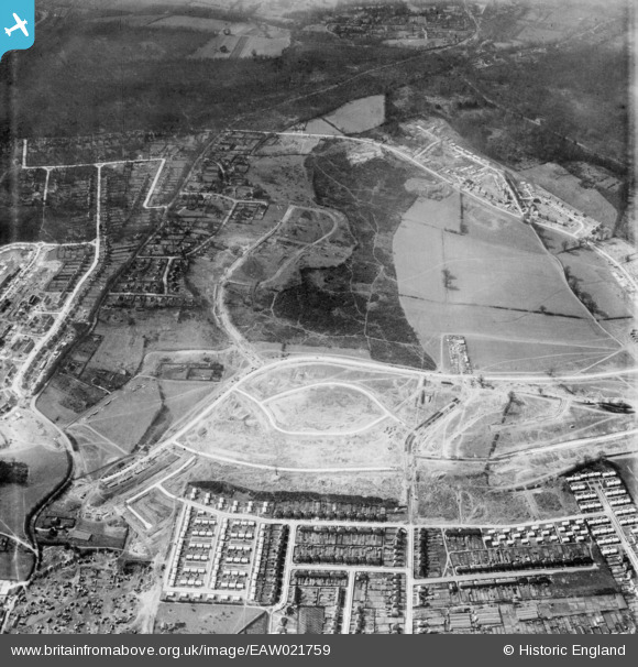
EAW021759 ENGLAND (1949). Housing estate under construction, St Paul's Cray, 1949
© Copyright OpenStreetMap contributors and licensed by the OpenStreetMap Foundation. 2024. Cartography is licensed as CC BY-SA.
Nearby Images (4)
EAW021759

EAW026810

EAW020734

EAW021758

Details
| Title | [EAW021759] Housing estate under construction, St Paul's Cray, 1949 |
| Reference | EAW021759 |
| Date | 1-April-1949 |
| Link | |
| Place name | ST PAUL'S CRAY |
| Parish | |
| District | |
| Country | ENGLAND |
| Easting / Northing | 546260, 169110 |
| Longitude / Latitude | 0.10288930906756, 51.401642591195 |
| National Grid Reference | TQ463691 |
Pins
 Darren russell |
Thursday 7th of August 2014 06:02:00 PM | |
Darren russell |
Thursday 7th of August 2014 06:00:54 PM | |
Darren russell |
Thursday 7th of August 2014 03:45:46 PM | |
 SteveSmith |
Tuesday 22nd of July 2014 12:12:32 AM | |
SteveSmith |
Tuesday 22nd of July 2014 12:11:25 AM | |
Gone2Kent |
Thursday 26th of December 2013 09:21:45 PM | |
Dr Woodall started his GP Practice here in the bungalow. |
Broom1 |
Tuesday 16th of February 2016 09:36:59 PM |