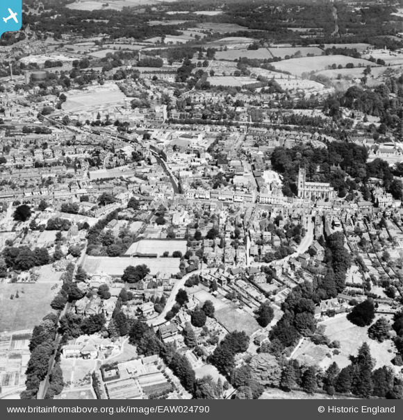
EAW024790 ENGLAND (1949). The town centre, East Grinstead, 1949
© Copyright OpenStreetMap contributors and licensed by the OpenStreetMap Foundation. 2024. Cartography is licensed as CC BY-SA.
Nearby Images (8)
Details
| Title | [EAW024790] The town centre, East Grinstead, 1949 |
| Reference | EAW024790 |
| Date | 12-July-1949 |
| Link | |
| Place name | EAST GRINSTEAD |
| Parish | EAST GRINSTEAD |
| District | |
| Country | ENGLAND |
| Easting / Northing | 539514, 137975 |
| Longitude / Latitude | -0.0061859983991748, 51.123519945034 |
| National Grid Reference | TQ395380 |
Pins
 JTJSwift |
Tuesday 11th of May 2021 08:22:19 AM | |
 Alan McFaden |
Saturday 28th of December 2013 05:57:53 PM | |
 Alan McFaden |
Saturday 28th of December 2013 05:57:18 PM | |
 Alan McFaden |
Saturday 28th of December 2013 05:56:26 PM |


![[EAW024790] The town centre, East Grinstead, 1949](http://britainfromabove.org.uk/sites/all/libraries/aerofilms-images/public/100x100/EAW/024/EAW024790.jpg)
![[EPW028559] St Swithin's Church and the town, East Grinstead, 1929](http://britainfromabove.org.uk/sites/all/libraries/aerofilms-images/public/100x100/EPW/028/EPW028559.jpg)
![[EAW024789] The town centre, East Grinstead, 1949](http://britainfromabove.org.uk/sites/all/libraries/aerofilms-images/public/100x100/EAW/024/EAW024789.jpg)
![[EAW024787] St Swinthun's Church, the cattle market and High Street, East Grinstead, 1949](http://britainfromabove.org.uk/sites/all/libraries/aerofilms-images/public/100x100/EAW/024/EAW024787.jpg)
![[EAW024792] The town centre, East Grinstead, 1949](http://britainfromabove.org.uk/sites/all/libraries/aerofilms-images/public/100x100/EAW/024/EAW024792.jpg)
![[EAW024791] The town centre, East Grinstead, 1949](http://britainfromabove.org.uk/sites/all/libraries/aerofilms-images/public/100x100/EAW/024/EAW024791.jpg)
![[EAW024788] The town centre, East Grinstead, 1949](http://britainfromabove.org.uk/sites/all/libraries/aerofilms-images/public/100x100/EAW/024/EAW024788.jpg)
![[EAW024786] The town centre, East Grinstead, 1949](http://britainfromabove.org.uk/sites/all/libraries/aerofilms-images/public/100x100/EAW/024/EAW024786.jpg)


