
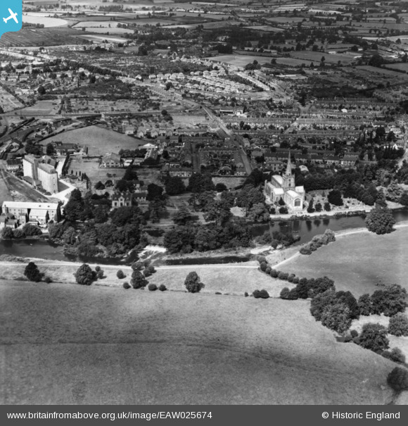
EAW025674 ENGLAND (1949). Holy Trinity Church and environs, Stratford-upon-Avon, 1949. This image has been produced from a print.
© Copyright OpenStreetMap contributors and licensed by the OpenStreetMap Foundation. 2024. Cartography is licensed as CC BY-SA.
Nearby Images (15)
EAW025674

EPW026844

EAW044189

EPW026846

EAW044191

EAW013454

EAW006660

EAW044190

EAW006659

EAW044192

EAW044187

EAW044188

EAW044236

EAW013456

EAW025673

Details
| Title | [EAW025674] Holy Trinity Church and environs, Stratford-upon-Avon, 1949. This image has been produced from a print. |
| Reference | EAW025674 |
| Date | 4-August-1949 |
| Link | |
| Place name | STRATFORD-UPON-AVON |
| Parish | STRATFORD-UPON-AVON |
| District | |
| Country | ENGLAND |
| Easting / Northing | 420088, 254228 |
| Longitude / Latitude | -1.7061428006741, 52.185528805149 |
| National Grid Reference | SP201542 |
Pins
 tony |
Thursday 25th of February 2016 12:11:42 PM | |
tony |
Thursday 25th of February 2016 12:10:07 PM | |
tony |
Thursday 25th of February 2016 12:08:27 PM | |
tony |
Thursday 25th of February 2016 12:07:37 PM | |
tony |
Thursday 25th of February 2016 12:05:53 PM |