
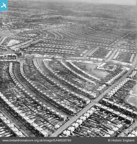
EAW028790 ENGLAND (1950). The residential area at Belmont in the snow, Stanmore, 1950
© Copyright OpenStreetMap contributors and licensed by the OpenStreetMap Foundation. 2024. Cartography is licensed as CC BY-SA.
Nearby Images (2)
EAW028790

EAW028789

Details
| Title | [EAW028790] The residential area at Belmont in the snow, Stanmore, 1950 |
| Reference | EAW028790 |
| Date | 25-April-1950 |
| Link | |
| Place name | STANMORE |
| Parish | |
| District | |
| Country | ENGLAND |
| Easting / Northing | 516697, 190217 |
| Longitude / Latitude | -0.31495459135023, 51.598220065737 |
| National Grid Reference | TQ167902 |
Pins
 John Crippen |
Sunday 5th of January 2020 11:13:08 PM | |
John Crippen |
Sunday 5th of January 2020 10:58:13 PM | |
lym |
Sunday 26th of August 2018 03:44:28 PM | |
The Laird |
Sunday 11th of February 2018 10:29:27 PM | |
nickdrew |
Wednesday 17th of December 2014 02:44:02 AM | |
Ian K |
Thursday 20th of February 2014 01:49:28 PM | |
Ian K |
Thursday 20th of February 2014 01:48:41 PM | |
Ian K |
Thursday 20th of February 2014 01:47:28 PM | |
Ian K |
Thursday 20th of February 2014 01:46:34 PM | |
Ian K |
Thursday 20th of February 2014 01:45:10 PM | |
Ian K |
Thursday 20th of February 2014 01:43:37 PM | |
Ian K |
Thursday 20th of February 2014 01:42:55 PM |