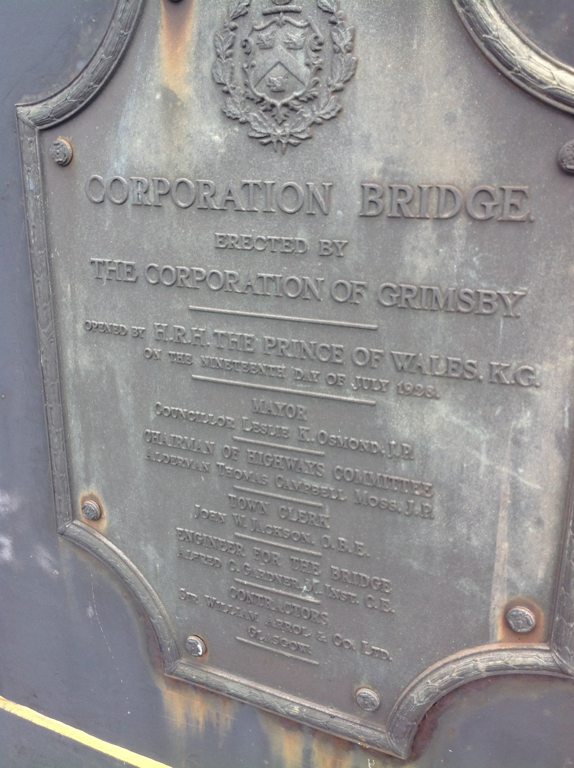
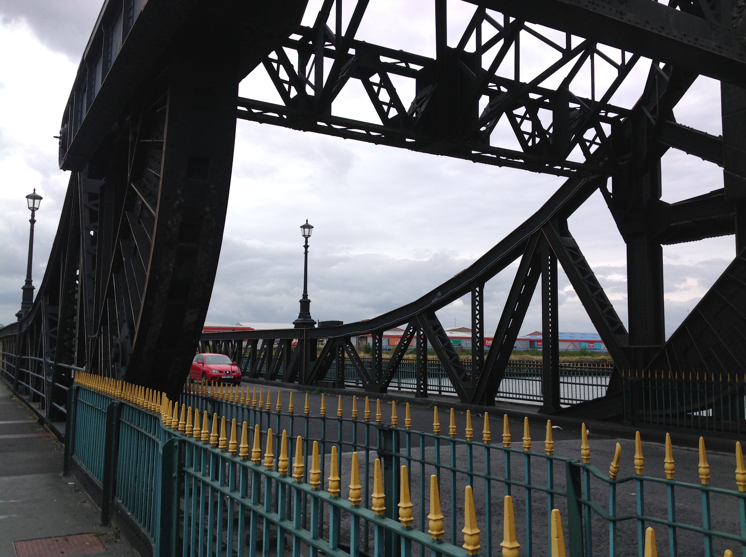
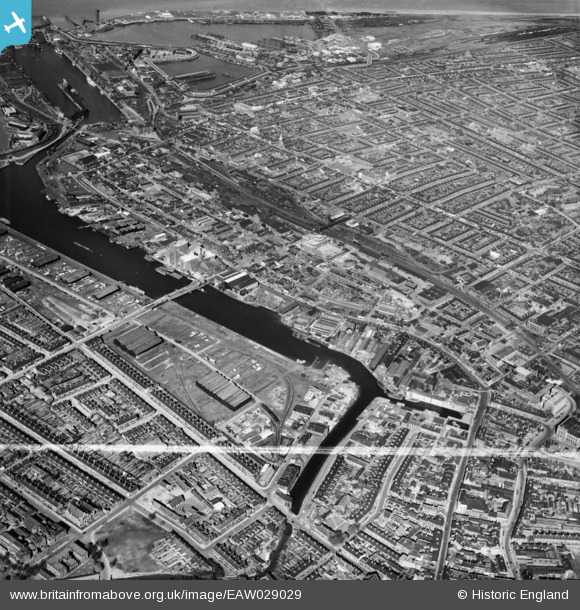
EAW029029 ENGLAND (1950). West Haven and the town, Grimsby, from the south-west, 1950. This image was marked by Aerofilms Ltd for photo editing.
© Copyright OpenStreetMap contributors and licensed by the OpenStreetMap Foundation. 2024. Cartography is licensed as CC BY-SA.
Nearby Images (2)
EAW029029

EPW042807

Details
| Title | [EAW029029] West Haven and the town, Grimsby, from the south-west, 1950. This image was marked by Aerofilms Ltd for photo editing. |
| Reference | EAW029029 |
| Date | 10-May-1950 |
| Link | |
| Place name | GRIMSBY |
| Parish | |
| District | |
| Country | ENGLAND |
| Easting / Northing | 526919, 409612 |
| Longitude / Latitude | -0.08328930983322, 53.567501861803 |
| National Grid Reference | TA269096 |
Pins
 redmist |
Wednesday 31st of October 2018 08:33:45 PM | |
redmist |
Wednesday 31st of October 2018 08:30:17 PM | |
 Class31 |
Sunday 2nd of November 2014 08:37:48 PM | |
Class31 |
Sunday 2nd of November 2014 08:30:30 PM | |
John Wass |
Sunday 2nd of November 2014 08:26:39 PM | |
Class31 |
Tuesday 4th of March 2014 07:11:32 PM | |
Class31 |
Tuesday 4th of March 2014 07:10:53 PM | |
Class31 |
Tuesday 4th of March 2014 07:10:12 PM | |
Class31 |
Monday 3rd of March 2014 04:55:46 PM |