
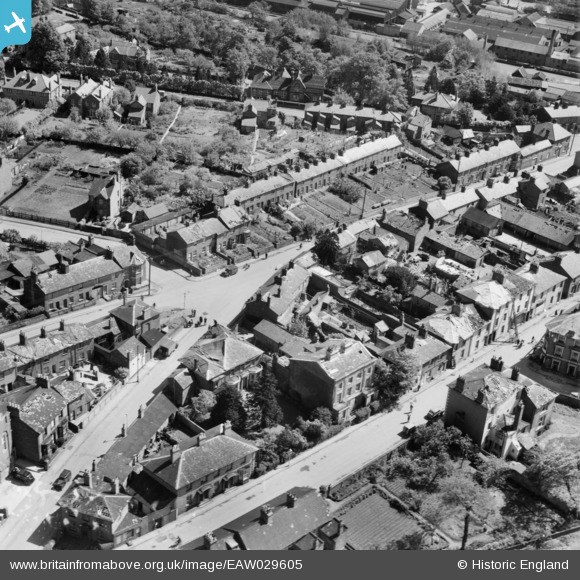
EAW029605 ENGLAND (1950). Old Road, Linslade, 1950
© Copyright OpenStreetMap contributors and licensed by the OpenStreetMap Foundation. 2024. Cartography is licensed as CC BY-SA.
Nearby Images (11)
EAW029605

EAW029607

EAW029606

EAW029604

EAW029602

EAW029603

EPW056945

EPW056943

EAW016586

EPW056944

EAW016585

Details
| Title | [EAW029605] Old Road, Linslade, 1950 |
| Reference | EAW029605 |
| Date | 22-May-1950 |
| Link | |
| Place name | LINSLADE |
| Parish | LEIGHTON-LINSLADE |
| District | |
| Country | ENGLAND |
| Easting / Northing | 491290, 225128 |
| Longitude / Latitude | -0.67252664094039, 51.916752057394 |
| National Grid Reference | SP913251 |
Pins
Be the first to add a comment to this image!
User Comment Contributions
The result of the tornado which struck Linslade on the 21st May 1950 can be seen in this series of photographs |
 Vonderene |
Friday 17th of October 2014 03:10:15 PM |