
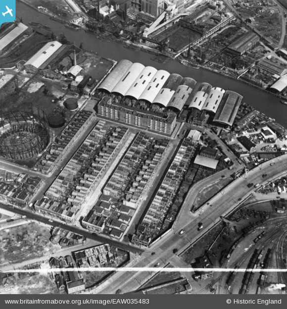
EAW035483 ENGLAND (1951). Oban Street, Moness Street, Portree Street and Commercial Wharf on the River Lea, South Bromley, 1951. This image has been produced from a print marked by Aerofilms Ltd for photo editing.
© Copyright OpenStreetMap contributors and licensed by the OpenStreetMap Foundation. 2024. Cartography is licensed as CC BY-SA.
Nearby Images (27)
EAW035483

EAW035484

EAW035482

EAW035477

EAW035481

EAW035480

EAW037181

EAW035479

EAW037183

EAW037185

EAW035478

EAW037177

EAW037184

EAW037180

EAW037186

EAW037179

EAW035489

EAW037178

EAW035487

EAW035488

EAW035504

EAW035485

EAW035490

EAW035486

EAW035502

EAW035492

EAW035493

Details
| Title | [EAW035483] Oban Street, Moness Street, Portree Street and Commercial Wharf on the River Lea, South Bromley, 1951. This image has been produced from a print marked by Aerofilms Ltd for photo editing. |
| Reference | EAW035483 |
| Date | 17-April-1951 |
| Link | |
| Place name | SOUTH BROMLEY |
| Parish | |
| District | |
| Country | ENGLAND |
| Easting / Northing | 538919, 181429 |
| Longitude / Latitude | 0.002253234533805, 51.514200262435 |
| National Grid Reference | TQ389814 |
Pins
Be the first to add a comment to this image!