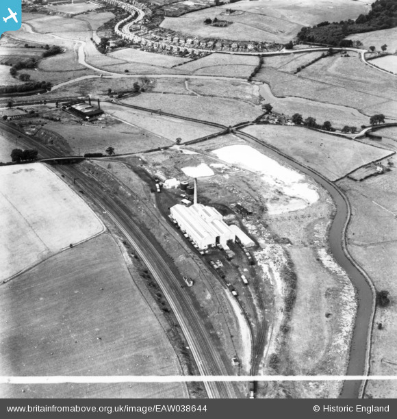
EAW038644 ENGLAND (1951). Vacuum Salt Ltd Salt Works, Baswich, 1951. This image has been produced from a print marked by Aerofilms Ltd for photo editing.

© Copyright OpenStreetMap contributors and licensed by the OpenStreetMap Foundation. 2024. Cartography is licensed as CC BY-SA.

Nearby Images (10)

EAW038644
  0° 0m
EAW038662
  156° 7m
EAW038661
  54° 29m
EAW038659
  43° 33m
EAW038656
  151° 42m
EAW038655
  72° 47m
EAW038658
  167° 47m
EAW038663
  20° 98m
EAW038645
  114° 152m
EAW038660
  43° 239m

Details

Title [EAW038644] Vacuum Salt Ltd Salt Works, Baswich, 1951. This image has been produced from a print marked by Aerofilms Ltd for photo editing.
Reference EAW038644
Date 14-August-1951
Link
Place name BASWICH
Parish
District
Country ENGLAND
Easting / Northing 394772, 322564
Longitude / Latitude -2.0775516355616, 52.800277531722
National Grid Reference SJ948226

Pins

PILLBOX (TYPE FW3/24): e58292 (Removed)

Matt Aldred edob.mattaldred.com
Sunday 8th of November 2020 11:16:38 PM
Tixall Road (DJJ)

David
Monday 8th of February 2016 12:58:35 AM
Staffordshire & Worcestershire Canal (DJJ)

David
Saturday 6th of February 2016 12:41:10 AM
The Stafford Branch Canal / River Sow Navigation. The Tow Path along the River Sow. (Stafford Riverway Link: www.stafford-riverway-link.co.uk )(DJJ)

David
Sunday 21st of December 2014 11:32:46 PM
Stafford Branch Canal / River Sow Navigation. The River Sow, about 1 mile from the former head of the Navigation at the Coal Wharf in the centre of Stafford by Green Bridge. (Stafford Riverway Link: www.stafford-riverway-link.co.uk )(DJJ)

David
Sunday 21st of December 2014 11:31:18 PM
Stafford Branch Canal / River Sow Navigation. The Branch Canal channel leading from the former Lock to the junction with the River Sow. Boats would turn left and follow the River Sow for about 1 mile to the Coal Wharf by Green Bridge in the centre of Stafford. (Stafford Riverway Link: www.stafford-riverway-link.co.uk )(DJJ)

David
Sunday 21st of December 2014 11:27:41 PM
Stafford Branch Canal / River Sow Navigation. The site of the former Basin of the Branch Canal leading towards the site of the Aqueduct and former Lock. The Lock was demolished in 1935. (Stafford Riverway Link: www.stafford-riverway-link.co.uk )(DJJ)

David
Sunday 21st of December 2014 11:24:50 PM
The Roving Bridge at the Junction of Stafford Branch Canal / River Sow Navigation with the Staffs and Worcs Canal. The Roving Bridge was blocked off in 1929. (Stafford Riverway Link: www.stafford-riverway-link.co.uk )(DJJ)

David
Sunday 21st of December 2014 11:22:23 PM
Junction of Stafford Branch Canal / River Sow Navigation with the Staffs and Worcs Canal. The Lock House. (Stafford Riverway Link: www.stafford-riverway-link.co.uk )(DJJ)

David
Sunday 21st of December 2014 11:19:54 PM
Entrance to the Canal Arm into the Salt Works at the junction with the Staffordshire & Worcestershire Canal. (DJJ),

David
Sunday 21st of December 2014 11:18:38 PM
The original Salt Works, west of Baswich Lane. Note the two chimneys. (DJJ).

David
Sunday 21st of December 2014 11:16:59 PM
The new Vacuum Salt Works, Baswich. Note the single chimney. (DJJ).

David
Sunday 21st of December 2014 11:15:47 PM
Footbridge over the River Penk. (Stafford Riverway Link: www.stafford-riverway-link.co.uk )(DJJ)

David
Sunday 21st of December 2014 11:14:27 PM
Road Bridge carrying Baswich Lane over the Railway. (DJJ).

David
Sunday 21st of December 2014 11:12:43 PM
St Thomas' Bridge (Bridge 101)carrying Baswich Lane over the Staffordshire & Worcestershire Canal. (DJJ).

David
Sunday 21st of December 2014 11:11:01 PM
The River Penk, close to its confluence with the River Sow. (DJJ).

David
Sunday 21st of December 2014 02:43:02 PM
Junction of Stafford Branch Canal / River Sow Navigation with the Staffs and Worcs Canal. Notice the Roving Bridge at the Junction and the Lock House. (Stafford Riverway Link: www.stafford-riverway-link.co.uk )(DJJ)

David
Sunday 21st of December 2014 12:22:50 PM