
Scheduled Maintenance
This website will undergo scheduled maintenance on Tuesday, September 10th, between 11:00 and 15:00, as well as on Thursday, September 12th, between 10:00 and 12:00. During this time, services may be temporarily disrupted. We apologise for any inconvenience.
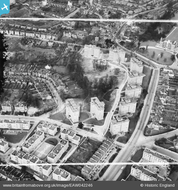
EAW042246 ENGLAND (1952). The Springfield Housing Estate, Charlton, 1952. This image was marked by Aerofilms Ltd for photo editing.
© Copyright OpenStreetMap contributors and licensed by the OpenStreetMap Foundation. 2024. Cartography is licensed as CC BY-SA.
Nearby Images (14)
EAW042246

EAW042244

EAW042247

EAW042242

EAW042245

EAW042243

EAW042250

EAW042241

EAW042249

EAW042248

EAW005424

EAW005423

EAW005427

EAW005430

Details
| Title | [EAW042246] The Springfield Housing Estate, Charlton, 1952. This image was marked by Aerofilms Ltd for photo editing. |
| Reference | EAW042246 |
| Date | 7-April-1952 |
| Link | |
| Place name | CHARLTON |
| Parish | |
| District | |
| Country | ENGLAND |
| Easting / Northing | 541300, 177740 |
| Longitude / Latitude | 0.035070180385139, 51.480457268177 |
| National Grid Reference | TQ413777 |
Pins
Be the first to add a comment to this image!