
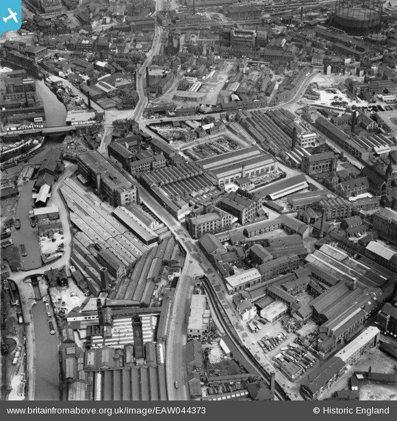
EAW044373 ENGLAND (1952). Industrial buildings around Water Lane, Leeds, 1952
© Copyright OpenStreetMap contributors and licensed by the OpenStreetMap Foundation. 2024. Cartography is licensed as CC BY-SA.
Nearby Images (14)
EAW044373

EAW044372

EPW050097

EAW044371

EAW044376

EAW044370

EPW050093

EPW050092

EPW050094

EPW050095

EAW044374

EPW050096

EPW050098

EAW044375

Details
| Title | [EAW044373] Industrial buildings around Water Lane, Leeds, 1952 |
| Reference | EAW044373 |
| Date | 27-June-1952 |
| Link | |
| Place name | LEEDS |
| Parish | |
| District | |
| Country | ENGLAND |
| Easting / Northing | 429747, 432895 |
| Longitude / Latitude | -1.5484011478194, 53.791302881037 |
| National Grid Reference | SE297329 |
