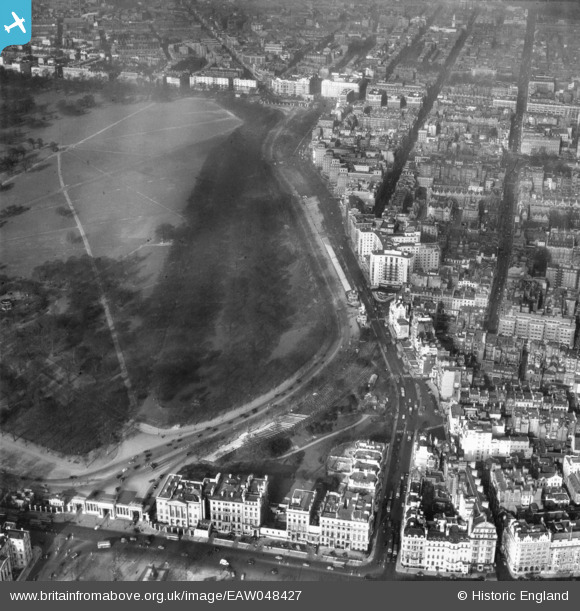
EAW048427 ENGLAND (1953). Hyde Park and the erection of stands in preparation for the coronation of Queen Elizabeth II along Park Lane, Hyde Park, 1953
© Copyright OpenStreetMap contributors and licensed by the OpenStreetMap Foundation. 2024. Cartography is licensed as CC BY-SA.
Nearby Images (26)
EAW048427

EAW048430

EPW028609

EAW021077

EPW028610A

EPW039062

EAW048429

EAW020844

EPW045390

EAW005244

EAW020843

EAW048872

EAW021078

EPW021408

EPW060543

EPW054295

EAW049025

EAW021084

EPW045391

EAW021079

EPW053004

EPW028605

EAW020835

EAW048863

EPW021884

EAW021086

Details
| Title | [EAW048427] Hyde Park and the erection of stands in preparation for the coronation of Queen Elizabeth II along Park Lane, Hyde Park, 1953 |
| Reference | EAW048427 |
| Date | 7-February-1953 |
| Link | |
| Place name | HYDE PARK |
| Parish | |
| District | |
| Country | ENGLAND |
| Easting / Northing | 528247, 180238 |
| Longitude / Latitude | -0.15190697796059, 51.506019718367 |
| National Grid Reference | TQ282802 |
Pins
 Alan McFaden |
Saturday 9th of August 2014 05:31:22 PM | |
Alan McFaden |
Thursday 5th of June 2014 07:36:12 PM | |
Alan McFaden |
Thursday 5th of June 2014 07:35:42 PM | |
Alan McFaden |
Thursday 5th of June 2014 07:35:09 PM |