
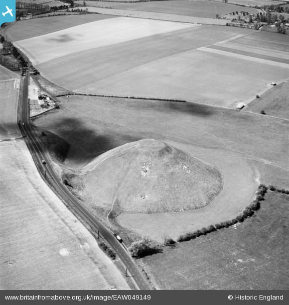
EAW049149 ENGLAND (1953). Silbury Hill, Avebury, 1953
© Copyright OpenStreetMap contributors and licensed by the OpenStreetMap Foundation. 2024. Cartography is licensed as CC BY-SA.
Nearby Images (13)
EAW049149

EAW007044

EAW034893

EAW034892

EAW007045

EAW034891

EAW034895

EAW034896

EAW034894

EAW007043

EAW002275

EAW049148

EAW049150

Details
| Title | [EAW049149] Silbury Hill, Avebury, 1953 |
| Reference | EAW049149 |
| Date | 5-May-1953 |
| Link | |
| Place name | AVEBURY |
| Parish | AVEBURY |
| District | |
| Country | ENGLAND |
| Easting / Northing | 410012, 168526 |
| Longitude / Latitude | -1.8560146174676, 51.415169950576 |
| National Grid Reference | SU100685 |
