Scheduled Maintenance
This website will undergo scheduled maintenance on Tuesday, August 6th, between 11:00 and 15:00, as well as on Thursday, August 8th, between 10:00 and 12:00.
During this time, services may be temporarily disrupted.
We apologise for any inconvenience.
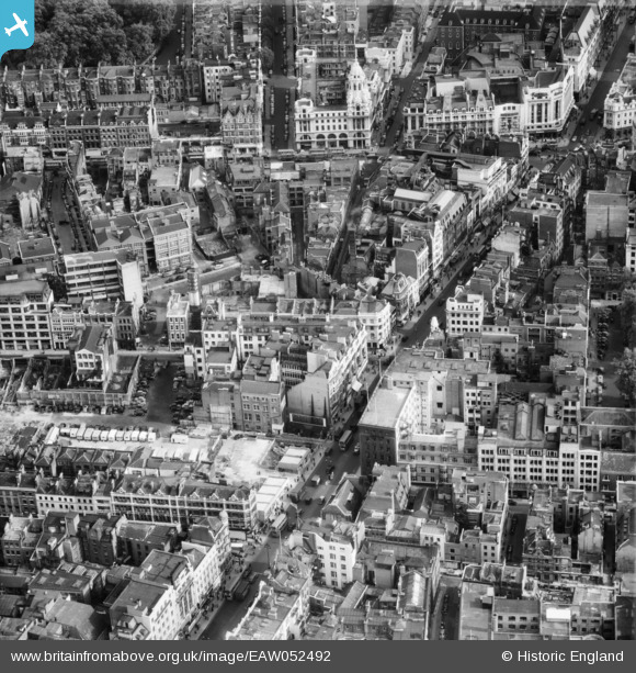
EAW052492 ENGLAND (1953). Oxford Street to the west of St Giles' Circus, Westminster, 1953
© Copyright OpenStreetMap contributors and licensed by the OpenStreetMap Foundation. 2024. Cartography is licensed as CC BY-SA.
Nearby Images (20)
EAW052492

EAW052491

EAW050855

EAW050835

EAW050858

EAW050862

EAW050857

EAW052493

EAW050848

EAW050842

EPW006168

EAW041947

EAW018341

EAW050834

EAW041943

EAW041948

EAW050851

EAW041949

EAW050860

EPW012737

Details
| Title | [EAW052492] Oxford Street to the west of St Giles' Circus, Westminster, 1953 |
| Reference | EAW052492 |
| Date | 30-September-1953 |
| Link | |
| Place name | WESTMINSTER |
| Parish | |
| District | |
| Country | ENGLAND |
| Easting / Northing | 529635, 181391 |
| Longitude / Latitude | -0.13149266554885, 51.516065791959 |
| National Grid Reference | TQ296814 |