
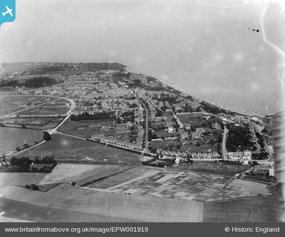
EPW001919 ENGLAND (1920). General view of Felixstowe, Felixstowe, from the west, 1920
© Copyright OpenStreetMap contributors and licensed by the OpenStreetMap Foundation. 2024. Cartography is licensed as CC BY-SA.
Nearby Images (4)
EPW001919

EAW024306

EAW024305

EPW001918

Details
| Title | [EPW001919] General view of Felixstowe, Felixstowe, from the west, 1920 |
| Reference | EPW001919 |
| Date | June-1920 |
| Link | |
| Place name | FELIXSTOWE |
| Parish | FELIXSTOWE |
| District | |
| Country | ENGLAND |
| Easting / Northing | 629627, 234365 |
| Longitude / Latitude | 1.3426543171944, 51.959835722349 |
| National Grid Reference | TM296344 |
Pins
 MB |
Saturday 23rd of January 2021 05:03:03 PM |