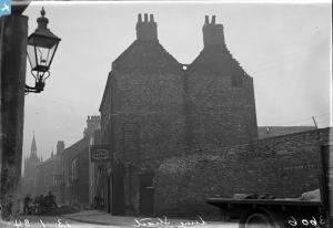
EPW009401 ENGLAND (1923). The North Bridge and Mills along the river, Kingston upon Hull, 1923
© Copyright OpenStreetMap contributors and licensed by the OpenStreetMap Foundation. 2024. Cartography is licensed as CC BY-SA.
Nearby Images (5)
Details
| Title | [EPW009401] The North Bridge and Mills along the river, Kingston upon Hull, 1923 |
| Reference | EPW009401 |
| Date | 1923 |
| Link | |
| Place name | KINGSTON UPON HULL |
| Parish | |
| District | |
| Country | ENGLAND |
| Easting / Northing | 510178, 429288 |
| Longitude / Latitude | -0.32900337562524, 53.748081726917 |
| National Grid Reference | TA102293 |
Pins
 CartoonHead |
Sunday 24th of May 2015 05:42:30 PM | |
 John Wass |
Tuesday 23rd of September 2014 04:12:04 PM | |
 John Wass |
Thursday 18th of September 2014 04:02:06 PM | |
 John Wass |
Thursday 18th of September 2014 04:00:26 PM |


![[EPW009401] The North Bridge and Mills along the river, Kingston upon Hull, 1923](http://britainfromabove.org.uk/sites/all/libraries/aerofilms-images/public/100x100/EPW/009/EPW009401.jpg)
![[EAW015646] The city, Kingston upon Hull, from the south, 1948](http://britainfromabove.org.uk/sites/all/libraries/aerofilms-images/public/100x100/EAW/015/EAW015646.jpg)
![[EPW055046] North Bridge and Witham, Kingston upon Hull, 1937. This image has been produced from a copy-negative.](http://britainfromabove.org.uk/sites/all/libraries/aerofilms-images/public/100x100/EPW/055/EPW055046.jpg)
![[EPW036505] Clarence Corn Mills, the River Hull and the city, Kingston upon Hull, from the south, 1931](http://britainfromabove.org.uk/sites/all/libraries/aerofilms-images/public/100x100/EPW/036/EPW036505.jpg)
![[EAW036964] Joseph Rank Ltd Clarence Corn Mills, Kingston upon Hull, 1951. This image has been produced from a print marked by Aerofilms Ltd for photo editing.](http://britainfromabove.org.uk/sites/all/libraries/aerofilms-images/public/100x100/EAW/036/EAW036964.jpg)
