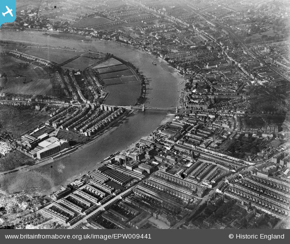
EPW009441 ENGLAND (1923). Hammesmith Bridge and environs, Hammersmith, 1923
© Copyright OpenStreetMap contributors and licensed by the OpenStreetMap Foundation. 2024. Cartography is licensed as CC BY-SA.
Nearby Images (4)
EPW009441

EPW025819

EPW055292

EPW059925

Details
| Title | [EPW009441] Hammesmith Bridge and environs, Hammersmith, 1923 |
| Reference | EPW009441 |
| Date | 1923 |
| Link | |
| Place name | HAMMERSMITH |
| Parish | |
| District | |
| Country | ENGLAND |
| Easting / Northing | 522996, 178036 |
| Longitude / Latitude | -0.22830405008384, 51.487395189282 |
| National Grid Reference | TQ230780 |
Pins
 Leslie B |
Friday 14th of May 2021 08:02:11 PM | |
Danno |
Saturday 4th of April 2020 12:46:23 PM | |
davidnugget |
Wednesday 5th of October 2016 09:47:42 AM | |
davidnugget |
Wednesday 5th of October 2016 09:42:12 AM | |
davidnugget |
Tuesday 4th of October 2016 09:26:32 PM | |
Mike H |
Saturday 25th of January 2014 09:50:04 PM | |
 Alan McFaden |
Saturday 16th of November 2013 04:23:46 PM |