
Scheduled Maintenance
This website will undergo scheduled maintenance on Tuesday, September 10th, between 11:00 and 15:00, as well as on Thursday, September 12th, between 10:00 and 12:00. During this time, services may be temporarily disrupted. We apologise for any inconvenience.
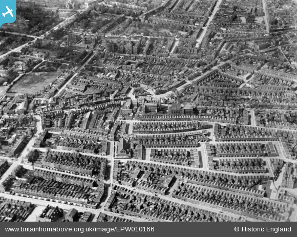
EPW010166 ENGLAND (1924). Wells Crescent and environs, Camberwell, 1924. This image has been produced from a copy-negative.
© Copyright OpenStreetMap contributors and licensed by the OpenStreetMap Foundation. 2024. Cartography is licensed as CC BY-SA.
Nearby Images (6)
EPW010166

EPW010160

EPW011157

EPW011158

EPW011159

EPW010956

Details
| Title | [EPW010166] Wells Crescent and environs, Camberwell, 1924. This image has been produced from a copy-negative. |
| Reference | EPW010166 |
| Date | April-1924 |
| Link | |
| Place name | CAMBERWELL |
| Parish | |
| District | |
| Country | ENGLAND |
| Easting / Northing | 533419, 177133 |
| Longitude / Latitude | -0.078594404361102, 51.476916085855 |
| National Grid Reference | TQ334771 |
Pins
 Chaz |
Sunday 8th of August 2021 12:34:53 AM | |
Chaz |
Sunday 8th of August 2021 12:24:49 AM | |
Chaz |
Sunday 8th of August 2021 12:21:26 AM | |
Chaz |
Sunday 8th of August 2021 12:17:42 AM | |
Chaz |
Sunday 8th of August 2021 12:15:55 AM | |
Chelsea61 |
Thursday 11th of September 2014 06:35:48 PM |