
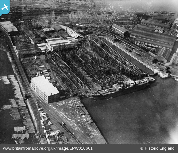
EPW010601 ENGLAND (1924). The Central Shipbuilding Yard, Hartlepool, 1924
© Copyright OpenStreetMap contributors and licensed by the OpenStreetMap Foundation. 2024. Cartography is licensed as CC BY-SA.
Nearby Images (5)
EPW010601

EPW010600

EPW010609

EAW007972

EPW010608

Details
| Title | [EPW010601] The Central Shipbuilding Yard, Hartlepool, 1924 |
| Reference | EPW010601 |
| Date | 14-June-1924 |
| Link | |
| Place name | HARTLEPOOL |
| Parish | |
| District | |
| Country | ENGLAND |
| Easting / Northing | 451566, 533794 |
| Longitude / Latitude | -1.1998282828715, 54.696426772456 |
| National Grid Reference | NZ516338 |
Pins
Be the first to add a comment to this image!