
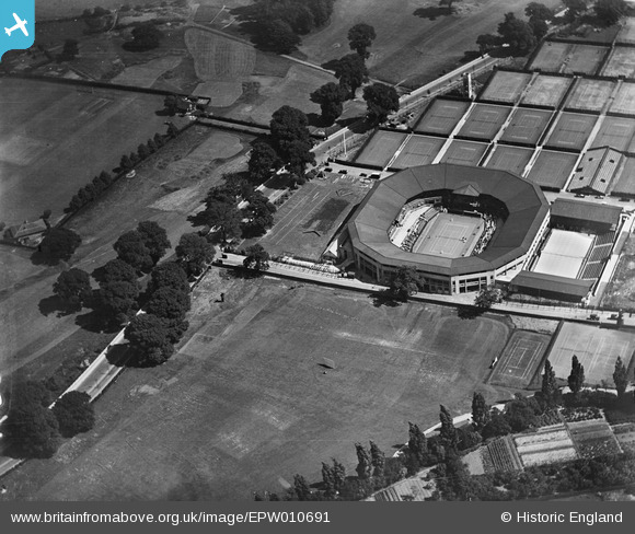
EPW010691 ENGLAND (1924). The All England Lawn Tennis Ground, Wimbledon, 1924
© Copyright OpenStreetMap contributors and licensed by the OpenStreetMap Foundation. 2024. Cartography is licensed as CC BY-SA.
Nearby Images (48)
EPW010691

EAW044365

EAW044362

EPW015862

EAW044367

EPW015861

EPW015866

EPW027539

EAW044366

EPW015864

EPW027537

EPW018560

EAW044360

EAW044361

EPW008872

EAW044353

EPW027538

EAW044351

EAW044355

EPW008877

EAW044354

EPW008874

EAW044357

EPW008873

EPW015860

EPW015863

EPW008526

EAW044352

EPW015873

EPW015872

EPW015875

EPW015874

EAW044358

EAW044368

EAW044359

EAW007281

EPW008875

EPW015871

EPW027613

EPW016646

EPW008876

EPW053654

EAW007283

EPW010690

EAW007282

EAW044356

EAW044363

EAW044369

Details
| Title | [EPW010691] The All England Lawn Tennis Ground, Wimbledon, 1924 |
| Reference | EPW010691 |
| Date | 21-June-1924 |
| Link | |
| Place name | WIMBLEDON |
| Parish | |
| District | |
| Country | ENGLAND |
| Easting / Northing | 524266, 172090 |
| Longitude / Latitude | -0.21210994405974, 51.433673761664 |
| National Grid Reference | TQ243721 |
Pins
Be the first to add a comment to this image!