
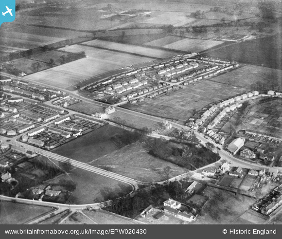
EPW020430 ENGLAND (1928). Hunters Grove and environs, Hayes, 1928
© Copyright OpenStreetMap contributors and licensed by the OpenStreetMap Foundation. 2024. Cartography is licensed as CC BY-SA.
Nearby Images (4)
EPW020430

EPW061231

EPW020682

EPW034900

Details
| Title | [EPW020430] Hunters Grove and environs, Hayes, 1928 |
| Reference | EPW020430 |
| Date | March-1928 |
| Link | |
| Place name | HAYES |
| Parish | |
| District | |
| Country | ENGLAND |
| Easting / Northing | 510036, 180035 |
| Longitude / Latitude | -0.41428142129603, 51.508035321342 |
| National Grid Reference | TQ100800 |
Pins
 KNITBY |
Thursday 11th of April 2019 10:14:39 PM | |
Brian |
Thursday 5th of February 2015 11:21:23 PM | |
Brian |
Thursday 5th of February 2015 11:19:50 PM | |
Brian |
Thursday 5th of February 2015 11:18:31 PM | |
Brian |
Thursday 5th of February 2015 11:17:55 PM | |
Brian |
Thursday 5th of February 2015 11:17:06 PM | |
Brian |
Thursday 5th of February 2015 11:16:06 PM | |
Brian |
Thursday 5th of February 2015 11:15:15 PM | |
Brian |
Thursday 5th of February 2015 11:14:00 PM | |
Brian |
Thursday 5th of February 2015 11:10:05 PM |