
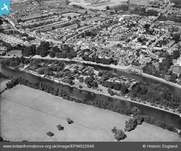
EPW022846 ENGLAND (1928). Eel Pie Island, Twickenham, 1928
© Copyright OpenStreetMap contributors and licensed by the OpenStreetMap Foundation. 2024. Cartography is licensed as CC BY-SA.
Nearby Images (9)
EPW022846

EAW025280

EAW025282

EAW025281

EPW023239

EPW023246

EPW022847

EPW023238

EPR000467

Details
| Title | [EPW022846] Eel Pie Island, Twickenham, 1928 |
| Reference | EPW022846 |
| Date | August-1928 |
| Link | |
| Place name | TWICKENHAM |
| Parish | |
| District | |
| Country | ENGLAND |
| Easting / Northing | 516459, 173165 |
| Longitude / Latitude | -0.32402689016411, 51.444995553891 |
| National Grid Reference | TQ165732 |
Pins
Be the first to add a comment to this image!