
Scheduled Maintenance
This website will undergo scheduled maintenance on Tuesday, September 10th, between 11:00 and 15:00, as well as on Thursday, September 12th, between 10:00 and 12:00. During this time, services may be temporarily disrupted. We apologise for any inconvenience.
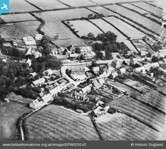
EPW029142 ENGLAND (1929). Porret Lane, the village school and environs, Hinderwell, 1929. This image has been produced from a copy-negative.
© Copyright OpenStreetMap contributors and licensed by the OpenStreetMap Foundation. 2024. Cartography is licensed as CC BY-SA.
Nearby Images (2)
EPW029142

EPW029140

Details
| Title | [EPW029142] Porret Lane, the village school and environs, Hinderwell, 1929. This image has been produced from a copy-negative. |
| Reference | EPW029142 |
| Date | September-1929 |
| Link | |
| Place name | HINDERWELL |
| Parish | HINDERWELL |
| District | |
| Country | ENGLAND |
| Easting / Northing | 479154, 516886 |
| Longitude / Latitude | -0.77639114472536, 54.540914503713 |
| National Grid Reference | NZ792169 |
Pins
Be the first to add a comment to this image!