
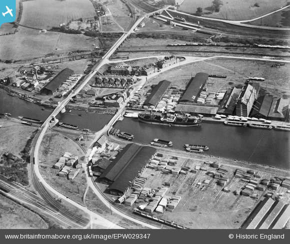
EPW029347 ENGLAND (1929). Timber yards at Sharpness Docks, Sharpness, 1929
© Copyright OpenStreetMap contributors and licensed by the OpenStreetMap Foundation. 2024. Cartography is licensed as CC BY-SA.
Nearby Images (6)
EPW029347

EPW037755

EPW029341

EPW037752

EPW005400

EAW038124

Details
| Title | [EPW029347] Timber yards at Sharpness Docks, Sharpness, 1929 |
| Reference | EPW029347 |
| Date | September-1929 |
| Link | |
| Place name | SHARPNESS |
| Parish | HINTON |
| District | |
| Country | ENGLAND |
| Easting / Northing | 367356, 202771 |
| Longitude / Latitude | -2.4726371625505, 51.722252702851 |
| National Grid Reference | SO674028 |
Pins
 MB |
Monday 22nd of August 2016 02:39:53 PM | |
MB |
Thursday 27th of December 2012 11:23:11 PM | |
MB |
Thursday 27th of December 2012 11:21:13 PM | |
MB |
Thursday 27th of December 2012 11:20:34 PM | |
MB |
Thursday 27th of December 2012 11:20:11 PM | |
MB |
Thursday 27th of December 2012 11:14:25 PM |