
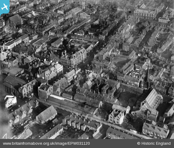
EPW031120 ENGLAND (1929). The junction of King Street and Bradshawgate and surroundings, Leigh, 1929
© Copyright OpenStreetMap contributors and licensed by the OpenStreetMap Foundation. 2024. Cartography is licensed as CC BY-SA.
Nearby Images (6)
EPW031120

EPW055097

EPW031121

EPW055092

EPW031118

EPW031122

Details
| Title | [EPW031120] The junction of King Street and Bradshawgate and surroundings, Leigh, 1929 |
| Reference | EPW031120 |
| Date | October-1929 |
| Link | |
| Place name | LEIGH |
| Parish | |
| District | |
| Country | ENGLAND |
| Easting / Northing | 365662, 400085 |
| Longitude / Latitude | -2.5176691097241, 53.496095169096 |
| National Grid Reference | SD657001 |
Pins
 gh |
Sunday 6th of June 2021 08:21:58 PM | |
gh |
Sunday 6th of June 2021 08:13:20 PM | |
wiganer |
Tuesday 15th of November 2016 06:46:37 PM | |
DFoxwell |
Friday 11th of April 2014 07:11:14 PM | |
DFoxwell |
Friday 11th of April 2014 07:08:05 PM | |
DFoxwell |
Friday 11th of April 2014 07:06:23 PM | |
SMJ |
Wednesday 5th of December 2012 03:06:27 PM |
