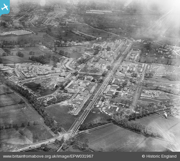
EPW031967 ENGLAND (1930). St Helier and environs, Morden, 1930
© Copyright OpenStreetMap contributors and licensed by the OpenStreetMap Foundation. 2024. Cartography is licensed as CC BY-SA.
Nearby Images (6)
Details
| Title | [EPW031967] St Helier and environs, Morden, 1930 |
| Reference | EPW031967 |
| Date | May-1930 |
| Link | |
| Place name | MORDEN |
| Parish | |
| District | |
| Country | ENGLAND |
| Easting / Northing | 526050, 167145 |
| Longitude / Latitude | -0.18821432490791, 51.388833251088 |
| National Grid Reference | TQ261671 |
Pins
 Biz |
Saturday 1st of May 2021 11:28:48 PM | |
 Biz |
Saturday 1st of May 2021 11:28:04 PM | |
 Biz |
Saturday 1st of May 2021 11:27:13 PM | |
 brianbeckett |
Monday 1st of June 2020 03:50:49 PM | |
 brianbeckett |
Monday 1st of June 2020 03:50:03 PM | |
 brianbeckett |
Monday 1st of June 2020 03:48:08 PM | |
 brianbeckett |
Monday 1st of June 2020 03:46:58 PM | |
 brianbeckett |
Monday 1st of June 2020 03:46:32 PM | |
 brianbeckett |
Monday 1st of June 2020 03:45:44 PM | |
 brianbeckett |
Monday 1st of June 2020 03:45:03 PM |


![[EPW031967] St Helier and environs, Morden, 1930](http://britainfromabove.org.uk/sites/all/libraries/aerofilms-images/public/100x100/EPW/031/EPW031967.jpg)
![[EPW031961] St Helier and environs, Morden, 1930](http://britainfromabove.org.uk/sites/all/libraries/aerofilms-images/public/100x100/EPW/031/EPW031961.jpg)
![[EPW031963] St Helier and environs, Morden, 1930](http://britainfromabove.org.uk/sites/all/libraries/aerofilms-images/public/100x100/EPW/031/EPW031963.jpg)
![[EPW031960] St Helier and environs, Morden, 1930](http://britainfromabove.org.uk/sites/all/libraries/aerofilms-images/public/100x100/EPW/031/EPW031960.jpg)
![[EPW031962] St Helier and environs, Morden, 1930](http://britainfromabove.org.uk/sites/all/libraries/aerofilms-images/public/100x100/EPW/031/EPW031962.jpg)
![[EPW031966] St Helier and environs, St Helier, 1930](http://britainfromabove.org.uk/sites/all/libraries/aerofilms-images/public/100x100/EPW/031/EPW031966.jpg)