
Scheduled Maintenance
This website will undergo scheduled maintenance on Tuesday, September 10th, between 11:00 and 15:00, as well as on Thursday, September 12th, between 10:00 and 12:00. During this time, services may be temporarily disrupted. We apologise for any inconvenience.
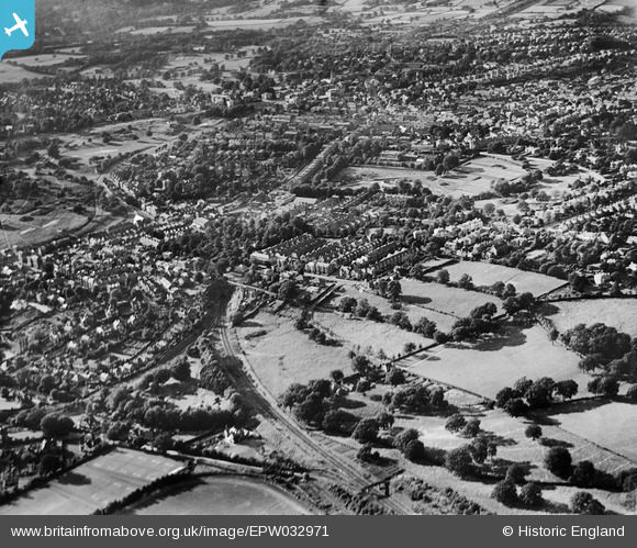
EPW032971 ENGLAND (1930). The town around Calverley Park, Royal Tunbridge Wells, from the south-west, 1930
© Copyright OpenStreetMap contributors and licensed by the OpenStreetMap Foundation. 2024. Cartography is licensed as CC BY-SA.
Nearby Images (21)
EPW032971

EAW053174

EAW053175

EPW032966

EAW053176

EAW053171

EAW053168

EAW053172

EAW053167

EAW053173

EPW032963

EPW032960

EAW053169

EPW032959

EPW032961

EPW032968

EPW032964

EPW032962

EAW053170

EPW032967

EPW032965

Details
| Title | [EPW032971] The town around Calverley Park, Royal Tunbridge Wells, from the south-west, 1930 |
| Reference | EPW032971 |
| Date | June-1930 |
| Link | |
| Place name | ROYAL TUNBRIDGE WELLS |
| Parish | |
| District | |
| Country | ENGLAND |
| Easting / Northing | 558806, 138586 |
| Longitude / Latitude | 0.26957020802324, 51.12398691992 |
| National Grid Reference | TQ588386 |
Pins
 John Wass |
Sunday 12th of April 2015 11:49:22 AM |