
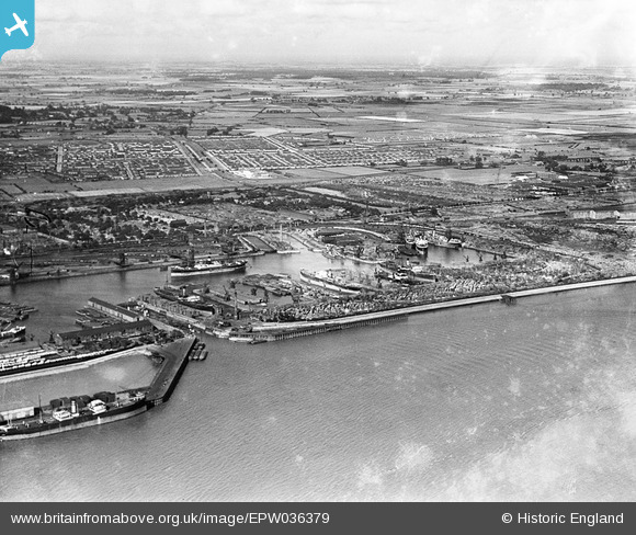
EPW036379 ENGLAND (1931). The Alexandra Dock and environs, Kingston upon Hull, from the south-west, 1931
© Copyright OpenStreetMap contributors and licensed by the OpenStreetMap Foundation. 2024. Cartography is licensed as CC BY-SA.
Nearby Images (8)
EPW036379

EPW036406

EAW004507

EAW046142

EAW046144

EPW036427

EPW036422

EPW010817

Details
| Title | [EPW036379] The Alexandra Dock and environs, Kingston upon Hull, from the south-west, 1931 |
| Reference | EPW036379 |
| Date | August-1931 |
| Link | |
| Place name | KINGSTON UPON HULL |
| Parish | |
| District | |
| Country | ENGLAND |
| Easting / Northing | 512482, 428592 |
| Longitude / Latitude | -0.29433035824225, 53.741335978239 |
| National Grid Reference | TA125286 |
Pins
Be the first to add a comment to this image!