
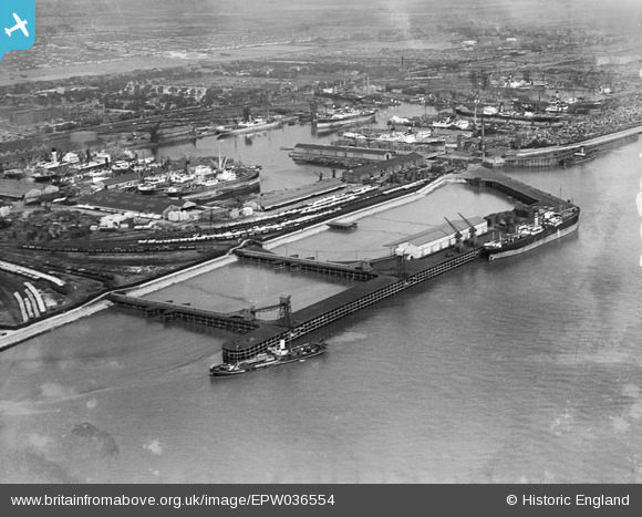
EPW036554 ENGLAND (1931). West Wharf and Alexandra Dock, Kingston upon Hull, 1931
© Copyright OpenStreetMap contributors and licensed by the OpenStreetMap Foundation. 2024. Cartography is licensed as CC BY-SA.
Nearby Images (13)
EPW036554

EAW004506

EPW036392

EPW036527

EPW010808

EPW036386

EAW324975

EPW010812

EAW046142

EPW036427

EPW010818

EPW036407

EPW036555

Details
| Title | [EPW036554] West Wharf and Alexandra Dock, Kingston upon Hull, 1931 |
| Reference | EPW036554 |
| Date | August-1931 |
| Link | |
| Place name | KINGSTON UPON HULL |
| Parish | |
| District | |
| Country | ENGLAND |
| Easting / Northing | 512084, 428637 |
| Longitude / Latitude | -0.30034635670709, 53.741826026276 |
| National Grid Reference | TA121286 |
Pins
Be the first to add a comment to this image!