
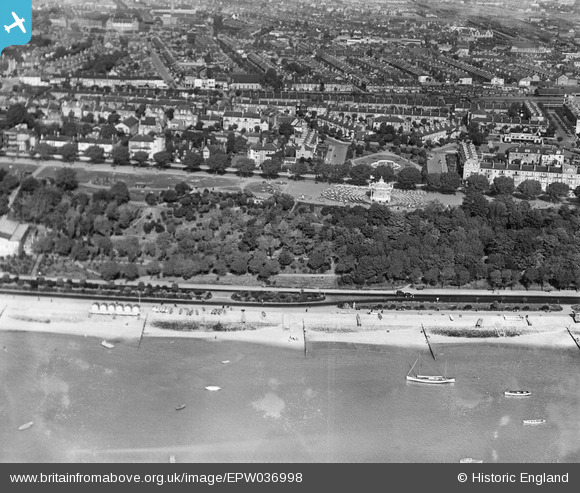
EPW036998 ENGLAND (1931). The Cliffs, band stand, and Clifftown Parade, Clifftown, from the south, 1931
© Copyright OpenStreetMap contributors and licensed by the OpenStreetMap Foundation. 2024. Cartography is licensed as CC BY-SA.
Nearby Images (18)
EPW036998

EPW036734

EPW000555

EPW036712

EPW037017

EAW002208

EAW002207

EPW024860

EPW040986

EPW037008

EPW024879

EPW058501

EPW036993

EPW024868

EPW000564

EPW036739

EPW036724

EPW054675

Details
| Title | [EPW036998] The Cliffs, band stand, and Clifftown Parade, Clifftown, from the south, 1931 |
| Reference | EPW036998 |
| Date | October-1931 |
| Link | |
| Place name | CLIFFTOWN |
| Parish | |
| District | |
| Country | ENGLAND |
| Easting / Northing | 587867, 185025 |
| Longitude / Latitude | 0.70892567471802, 51.532346827937 |
| National Grid Reference | TQ879850 |
Pins
Be the first to add a comment to this image!