
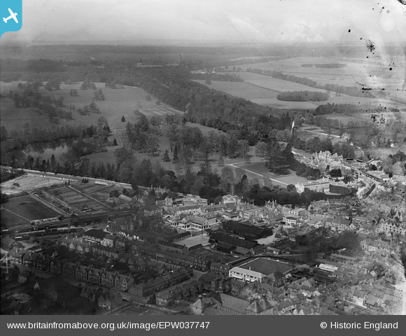
EPW037747 ENGLAND (1932). Cirencester Park and the town, Cirencester, 1932. This image has been produced from a damaged negative.
© Copyright OpenStreetMap contributors and licensed by the OpenStreetMap Foundation. 2024. Cartography is licensed as CC BY-SA.
Nearby Images (6)
EPW037747

EPW037748

EAW015787

EAW015790

EAW015786

EAW031679

Details
| Title | [EPW037747] Cirencester Park and the town, Cirencester, 1932. This image has been produced from a damaged negative. |
| Reference | EPW037747 |
| Date | May-1932 |
| Link | |
| Place name | CIRENCESTER |
| Parish | CIRENCESTER |
| District | |
| Country | ENGLAND |
| Easting / Northing | 401803, 201958 |
| Longitude / Latitude | -1.9738989408529, 51.715889613426 |
| National Grid Reference | SP018020 |
Pins
 gBr |
Sunday 30th of August 2015 08:36:33 PM | |
SydM |
Sunday 31st of March 2013 06:12:33 PM | |
 Class31 |
Thursday 24th of January 2013 09:05:19 PM | |
Class31 |
Thursday 24th of January 2013 09:04:47 PM | |
Class31 |
Thursday 24th of January 2013 09:03:59 PM | |
Class31 |
Thursday 24th of January 2013 09:00:55 PM | |
Class31 |
Thursday 24th of January 2013 09:00:08 PM |