Scheduled Maintenance
This website will undergo scheduled maintenance on Tuesday, September 10th, between 11:00 and 15:00, as well as on Thursday, September 12th, between 10:00 and 12:00. During this time, services may be temporarily disrupted. We apologise for any inconvenience.
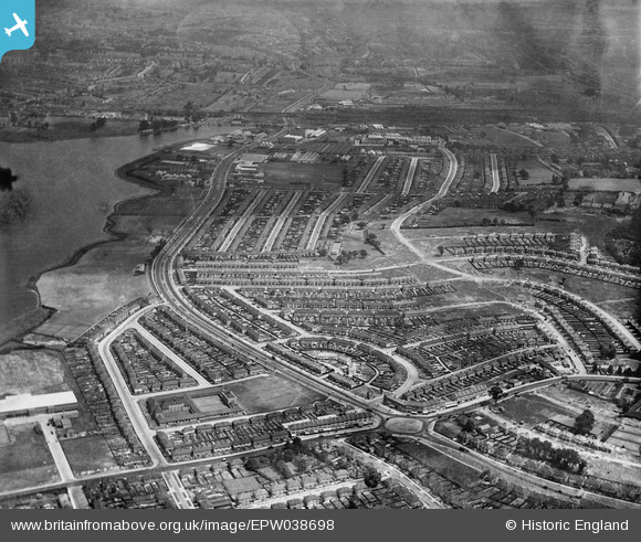
EPW038698 ENGLAND (1932). The Circle and housing off the North Circular Road, Neasden, from the south-west, 1932
© Copyright OpenStreetMap contributors and licensed by the OpenStreetMap Foundation. 2024. Cartography is licensed as CC BY-SA.
Nearby Images (6)
EPW038698

EPW038695

EPW038697

EPW046499

EPW046497

EPW038696

Details
| Title | [EPW038698] The Circle and housing off the North Circular Road, Neasden, from the south-west, 1932 |
| Reference | EPW038698 |
| Date | June-1932 |
| Link | |
| Place name | NEASDEN |
| Parish | |
| District | |
| Country | ENGLAND |
| Easting / Northing | 521293, 186248 |
| Longitude / Latitude | -0.24999457414509, 51.561574840524 |
| National Grid Reference | TQ213862 |
Pins
 Class31 |
Monday 13th of October 2014 11:46:40 AM | |
Class31 |
Monday 13th of October 2014 11:33:35 AM | |
Class31 |
Sunday 2nd of March 2014 11:40:40 PM | |
 Gladstone Hay |
Thursday 5th of December 2013 11:06:00 PM |