
Scheduled Maintenance
This website will undergo scheduled maintenance on Tuesday, September 10th, between 11:00 and 15:00, as well as on Thursday, September 12th, between 10:00 and 12:00. During this time, services may be temporarily disrupted. We apologise for any inconvenience.
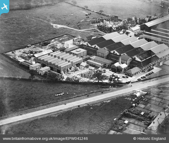
EPW041246 ENGLAND (1933). The British and Dominions Film Studios, Borehamwood, 1933
© Copyright OpenStreetMap contributors and licensed by the OpenStreetMap Foundation. 2024. Cartography is licensed as CC BY-SA.
Nearby Images (41)
EPW041246

EAW027908

EAW027907

EAW027909

EAW027914

EPW041242

EPW041248

EAW027910

EAW027904

EAW027905

EPW041243

EAW027912

EAW027913

EPW041244

EAW027903

EPW041245

EAW027911

EPW041247

EAW027906

EAW023318

EPW061089
 Film Studios, Borehamwood, 1939")
EAW028294
 Studios on Shenley Road, Borehamwood, 1950")
EPW025490

EAW028292
 Studios on Shenley Road, Borehamwood, 1950")
EAW028072

EAW028073

EAW028289
 Studios on Shenley Road, Borehamwood, 1950")
EPW021912

EAW028075

EAW028291
 Studios on Shenley Road, Borehamwood, 1950")
EAW023317

EAW028293
 Studios on Shenley Road, Borehamwood, 1950")
EAW028071

EPW021913

EPW025493

EPW046576

EPW021914

EPW025492

EAW028070

EAW028290
 Studios on Shenley Road, Borehamwood, 1950")
EAW044272

Details
| Title | [EPW041246] The British and Dominions Film Studios, Borehamwood, 1933 |
| Reference | EPW041246 |
| Date | May-1933 |
| Link | |
| Place name | BOREHAMWOOD |
| Parish | ELSTREE AND BOREHAMWOOD |
| District | |
| Country | ENGLAND |
| Easting / Northing | 519905, 196940 |
| Longitude / Latitude | -0.26635277468618, 51.657973813688 |
| National Grid Reference | TQ199969 |
Pins
Be the first to add a comment to this image!