
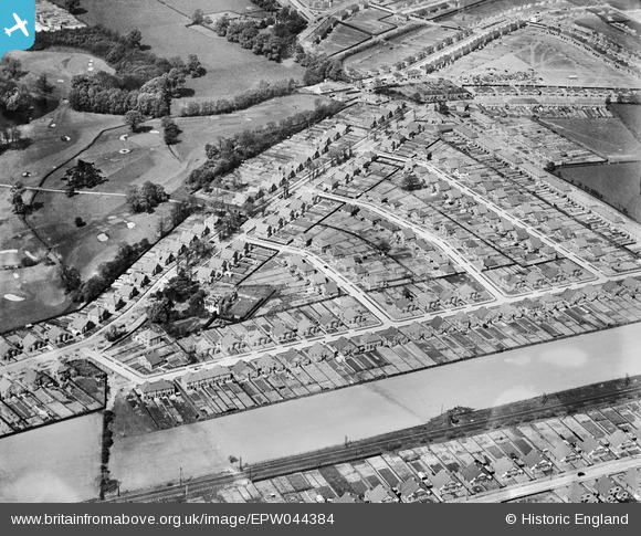
EPW044384 ENGLAND (1934). The Montrose Park Estate between Hurst Road and Canterbury Avenue, Sidcup, 1934
© Copyright OpenStreetMap contributors and licensed by the OpenStreetMap Foundation. 2024. Cartography is licensed as CC BY-SA.
Nearby Images (9)
EPW044384

EPW044386

EPW044380

EPW044381

EPW044383

EPW044385

EPW044387

EPW038192

EPW038255

Details
| Title | [EPW044384] The Montrose Park Estate between Hurst Road and Canterbury Avenue, Sidcup, 1934 |
| Reference | EPW044384 |
| Date | May-1934 |
| Link | |
| Place name | SIDCUP |
| Parish | |
| District | |
| Country | ENGLAND |
| Easting / Northing | 547138, 172985 |
| Longitude / Latitude | 0.11711260457783, 51.436238141306 |
| National Grid Reference | TQ471730 |
Pins
Be the first to add a comment to this image!