
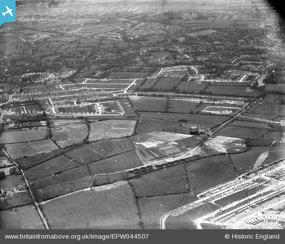
EPW044507 ENGLAND (1934). Harrow U.D. Council Sewage Works, The Croft and environs, Pinner, 1934
© Copyright OpenStreetMap contributors and licensed by the OpenStreetMap Foundation. 2024. Cartography is licensed as CC BY-SA.
Nearby Images (3)
EPW044507

EPW031253

EPW044202

Details
| Title | [EPW044507] Harrow U.D. Council Sewage Works, The Croft and environs, Pinner, 1934 |
| Reference | EPW044507 |
| Date | May-1934 |
| Link | |
| Place name | PINNER |
| Parish | |
| District | |
| Country | ENGLAND |
| Easting / Northing | 511778, 187790 |
| Longitude / Latitude | -0.38672451562001, 51.577402107347 |
| National Grid Reference | TQ118878 |
Pins
 DeeCee |
Monday 9th of January 2023 08:54:26 PM | |
DeeCee |
Monday 9th of January 2023 08:52:01 PM | |
DeeCee |
Monday 9th of January 2023 08:51:15 PM | |
DeeCee |
Monday 9th of January 2023 08:49:56 PM | |
DeeCee |
Monday 9th of January 2023 08:49:37 PM | |
DeeCee |
Monday 9th of January 2023 08:48:49 PM | |
czyrko |
Thursday 26th of August 2021 04:53:54 PM | |
czyrko |
Thursday 26th of August 2021 04:52:03 PM | |
Lynda Tubbs |
Thursday 16th of January 2014 02:16:19 PM | |
Nick Pitt |
Tuesday 2nd of July 2013 04:52:50 PM | |
Nick Pitt |
Tuesday 2nd of July 2013 04:52:08 PM |