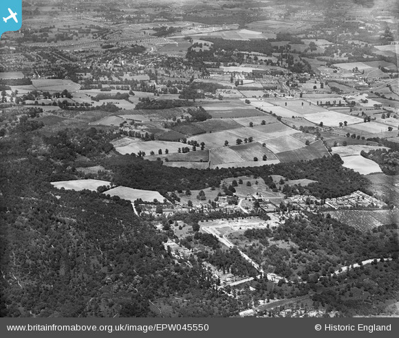
EPW045550 ENGLAND (1934). Hoblingwell Wood, Housing under construction along Marlings Park Avenue and environs, Scadbury Park, from the south-west, 1934
© Copyright OpenStreetMap contributors and licensed by the OpenStreetMap Foundation. 2024. Cartography is licensed as CC BY-SA.
Nearby Images (2)
EPW045550

EAW026816

Details
| Title | [EPW045550] Hoblingwell Wood, Housing under construction along Marlings Park Avenue and environs, Scadbury Park, from the south-west, 1934 |
| Reference | EPW045550 |
| Date | July-1934 |
| Link | |
| Place name | SCADBURY PARK |
| Parish | |
| District | |
| Country | ENGLAND |
| Easting / Northing | 545472, 168864 |
| Longitude / Latitude | 0.091466902254226, 51.39963454319 |
| National Grid Reference | TQ455689 |
Pins
 Gone2Kent |
Sunday 2nd of March 2014 08:16:44 PM |