
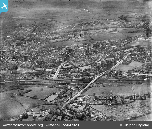
EPW047328 ENGLAND (1935). Stafford Railway Station and the town, Stafford, from the south-west, 1935
© Copyright OpenStreetMap contributors and licensed by the OpenStreetMap Foundation. 2024. Cartography is licensed as CC BY-SA.
Nearby Images (4)
EPW047328

EPW047327

EPW020053

EAW024956

Details
| Title | [EPW047328] Stafford Railway Station and the town, Stafford, from the south-west, 1935 |
| Reference | EPW047328 |
| Date | May-1935 |
| Link | |
| Place name | STAFFORD |
| Parish | |
| District | |
| Country | ENGLAND |
| Easting / Northing | 391813, 322759 |
| Longitude / Latitude | -2.1214499451534, 52.801993880842 |
| National Grid Reference | SJ918228 |
Pins
 MorningDJ |
Thursday 25th of March 2021 10:30:29 AM | |
PURCELL |
Sunday 6th of April 2014 10:08:02 AM | |
PURCELL |
Sunday 6th of April 2014 10:07:17 AM | |
 cidge |
Tuesday 10th of December 2013 10:52:22 PM | |
cidge |
Tuesday 10th of December 2013 10:41:55 PM | |
cidge |
Tuesday 10th of December 2013 10:38:58 PM | |
cidge |
Tuesday 10th of December 2013 10:36:25 PM | |
cidge |
Tuesday 10th of December 2013 10:35:31 PM |