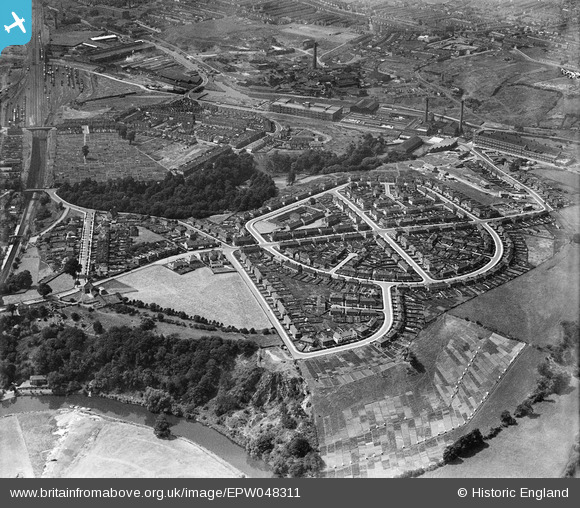
EPW048311 ENGLAND (1935). The residential area at St Anne's Park, Bristol, 1935
© Copyright OpenStreetMap contributors and licensed by the OpenStreetMap Foundation. 2024. Cartography is licensed as CC BY-SA.
Nearby Images (4)
EPW048311

EPW048310

EPW050563

EPW050464

Details
| Title | [EPW048311] The residential area at St Anne's Park, Bristol, 1935 |
| Reference | EPW048311 |
| Date | July-1935 |
| Link | |
| Place name | BRISTOL |
| Parish | |
| District | |
| Country | ENGLAND |
| Easting / Northing | 362433, 172417 |
| Longitude / Latitude | -2.5406624180889, 51.449002086931 |
| National Grid Reference | ST624724 |
Pins
 Pennyjames |
Tuesday 14th of March 2023 02:39:41 PM | |
Pennyjames |
Tuesday 14th of March 2023 02:37:14 PM | |
Pennyjames |
Tuesday 14th of March 2023 02:34:22 PM | |
 Class31 |
Monday 11th of May 2015 08:01:38 AM |