
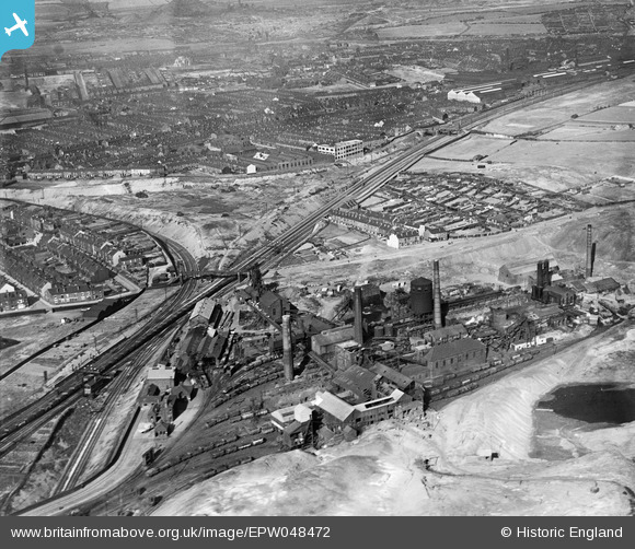
EPW048472 ENGLAND (1935). The Nunnery Colliery, Sheffield, 1935
© Copyright OpenStreetMap contributors and licensed by the OpenStreetMap Foundation. 2024. Cartography is licensed as CC BY-SA.
Nearby Images (10)
EPW048472

EPW048478

EPW048474

EPW048475

EPW048480

EPW048477

EPW048473

EPW048476

EPW048481

EPW048479

Details
| Title | [EPW048472] The Nunnery Colliery, Sheffield, 1935 |
| Reference | EPW048472 |
| Date | July-1935 |
| Link | |
| Place name | SHEFFIELD |
| Parish | |
| District | |
| Country | ENGLAND |
| Easting / Northing | 437921, 387846 |
| Longitude / Latitude | -1.4297924194046, 53.385831403795 |
| National Grid Reference | SK379878 |
Pins
 Peter Turvey |
Tuesday 24th of September 2024 05:55:26 PM | |
Seamus610 |
Saturday 22nd of August 2020 04:23:47 PM | |
Seamus610 |
Saturday 22nd of August 2020 04:20:08 PM | |
Seamus610 |
Saturday 22nd of August 2020 04:18:54 PM | |
Seamus610 |
Saturday 22nd of August 2020 04:14:18 PM | |
Seamus610 |
Saturday 22nd of August 2020 04:12:19 PM |