
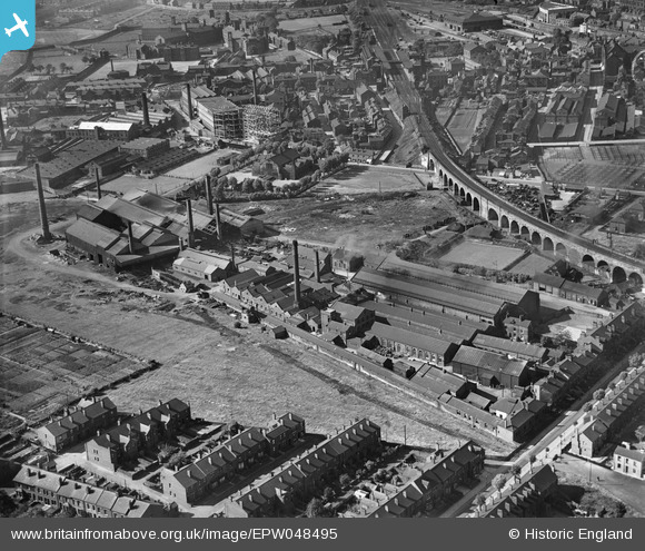
EPW048495 ENGLAND (1935). The British Ropes Ltd Works, Wakefield, 1935
© Copyright OpenStreetMap contributors and licensed by the OpenStreetMap Foundation. 2024. Cartography is licensed as CC BY-SA.
Nearby Images (8)
EPW048495

EPW048496

EPW048497

EPW048493

EPW048499

EPW048500

EPW048498

EPW048494

Details
| Title | [EPW048495] The British Ropes Ltd Works, Wakefield, 1935 |
| Reference | EPW048495 |
| Date | July-1935 |
| Link | |
| Place name | WAKEFIELD |
| Parish | |
| District | |
| Country | ENGLAND |
| Easting / Northing | 432912, 420236 |
| Longitude / Latitude | -1.5017017492311, 53.677323512915 |
| National Grid Reference | SE329202 |
Pins
 sirdouglas |
Friday 4th of April 2014 01:40:14 PM | |
sirdouglas |
Friday 4th of April 2014 01:37:32 PM | |
sirdouglas |
Friday 4th of April 2014 01:30:33 PM |