
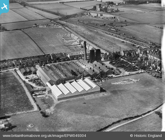
EPW049304 ENGLAND (1935). The British Ropes Ltd Rope Works on Ollerton Road, Retford, 1935
© Copyright OpenStreetMap contributors and licensed by the OpenStreetMap Foundation. 2024. Cartography is licensed as CC BY-SA.
Nearby Images (7)
EPW049304

EPW049308

EPW049309

EPW049310

EPW049305

EPW049306

EPW049307

Details
| Title | [EPW049304] The British Ropes Ltd Rope Works on Ollerton Road, Retford, 1935 |
| Reference | EPW049304 |
| Date | September-1935 |
| Link | |
| Place name | RETFORD |
| Parish | |
| District | |
| Country | ENGLAND |
| Easting / Northing | 470165, 379965 |
| Longitude / Latitude | -0.94676516031967, 53.311696058155 |
| National Grid Reference | SK702800 |
Pins
 MB |
Saturday 11th of May 2013 08:57:08 PM | |
MB |
Saturday 11th of May 2013 08:56:45 PM | |
MB |
Saturday 11th of May 2013 08:55:59 PM | |
MB |
Saturday 11th of May 2013 08:55:24 PM | |
MB |
Saturday 11th of May 2013 08:54:41 PM | |
MB |
Saturday 11th of May 2013 08:54:17 PM |
User Comment Contributions
grid references don't appear to match location exactly with OS map |
MB |
Saturday 11th of May 2013 09:01:40 PM |