
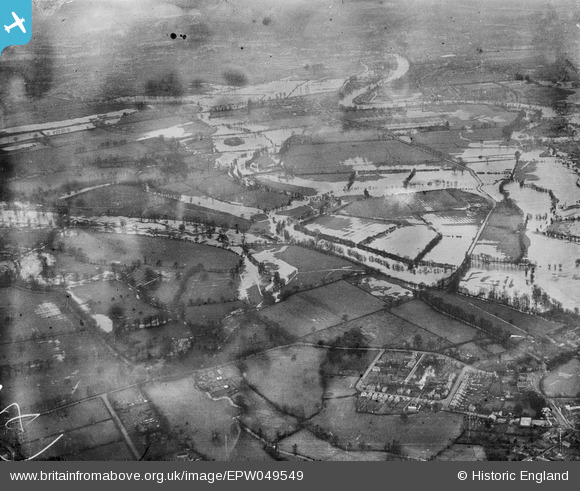
EPW049549 ENGLAND (1936). River Thames in flood around Abbey Mead, Chertsey, from the south-west, 1936. This image has been produced from a damaged negative.
© Copyright OpenStreetMap contributors and licensed by the OpenStreetMap Foundation. 2024. Cartography is licensed as CC BY-SA.
Nearby Images (4)
EPW049549

EAW044718

EAW044717

EAW044721

Details
| Title | [EPW049549] River Thames in flood around Abbey Mead, Chertsey, from the south-west, 1936. This image has been produced from a damaged negative. |
| Reference | EPW049549 |
| Date | January-1936 |
| Link | |
| Place name | CHERTSEY |
| Parish | |
| District | |
| Country | ENGLAND |
| Easting / Northing | 503640, 167409 |
| Longitude / Latitude | -0.51011879060438, 51.395743097727 |
| National Grid Reference | TQ036674 |
Pins
Be the first to add a comment to this image!