
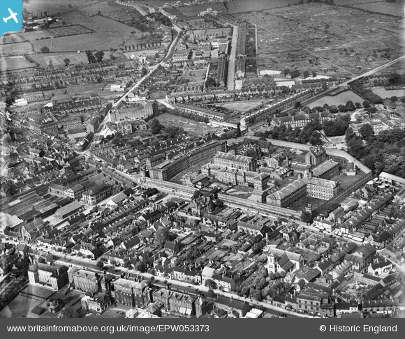
EPW053373 ENGLAND (1937). HM Prison Stafford and the town centre, Stafford, 1937
© Copyright OpenStreetMap contributors and licensed by the OpenStreetMap Foundation. 2024. Cartography is licensed as CC BY-SA.
Nearby Images (11)
EPW053373

EAW001864

EPW056774

EPW056777

EPW034019

EPW056776

EPW056772

EPW056778

EPW056773

EPW056775

EAW024959

Details
| Title | [EPW053373] HM Prison Stafford and the town centre, Stafford, 1937 |
| Reference | EPW053373 |
| Date | 30-May-1937 |
| Link | |
| Place name | STAFFORD |
| Parish | |
| District | |
| Country | ENGLAND |
| Easting / Northing | 392155, 323869 |
| Longitude / Latitude | -2.1164032111862, 52.811978409817 |
| National Grid Reference | SJ922239 |
Pins
Be the first to add a comment to this image!