
Scheduled Maintenance
This website will undergo scheduled maintenance on Tuesday, September 10th, between 11:00 and 15:00, as well as on Thursday, September 12th, between 10:00 and 12:00. During this time, services may be temporarily disrupted. We apologise for any inconvenience.
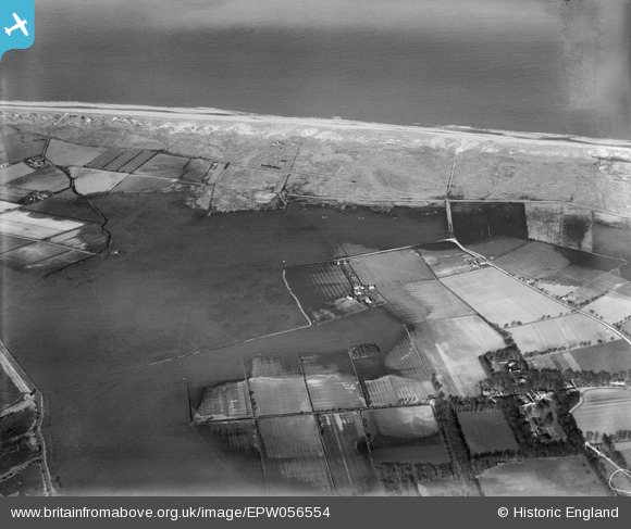
EPW056554 ENGLAND (1938). Flooding around Horsey Corner, Horsey, 1938
© Copyright OpenStreetMap contributors and licensed by the OpenStreetMap Foundation. 2024. Cartography is licensed as CC BY-SA.
Nearby Images (2)
EPW056554

EPW056478

Details
| Title | [EPW056554] Flooding around Horsey Corner, Horsey, 1938 |
| Reference | EPW056554 |
| Date | 12-March-1938 |
| Link | |
| Place name | HORSEY |
| Parish | HORSEY |
| District | |
| Country | ENGLAND |
| Easting / Northing | 645712, 323824 |
| Longitude / Latitude | 1.641801171572, 52.755709595344 |
| National Grid Reference | TG457238 |
Pins
 incony |
Friday 5th of April 2019 01:38:23 PM |