
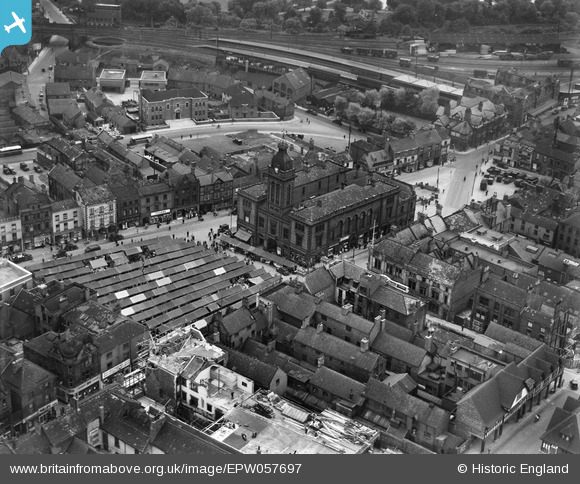
EPW057697 ENGLAND (1938). The Market Hall and Market Place, Chesterfield, 1938
© Copyright OpenStreetMap contributors and licensed by the OpenStreetMap Foundation. 2024. Cartography is licensed as CC BY-SA.
Nearby Images (10)
EPW057697

EPW021079

EPW021076

EPW057701

EPW021083

EPW021084

EPW021078

EPW057698

EPW057700

EPW057696

Details
| Title | [EPW057697] The Market Hall and Market Place, Chesterfield, 1938 |
| Reference | EPW057697 |
| Date | 20-June-1938 |
| Link | |
| Place name | CHESTERFIELD |
| Parish | |
| District | |
| Country | ENGLAND |
| Easting / Northing | 438190, 371094 |
| Longitude / Latitude | -1.4277650805053, 53.235223309957 |
| National Grid Reference | SK382711 |
Pins
 DaveH |
Tuesday 13th of October 2020 02:53:23 AM | |
DaveH |
Tuesday 13th of October 2020 02:52:37 AM | |
DaveH |
Tuesday 13th of October 2020 02:52:16 AM | |
DaveH |
Tuesday 13th of October 2020 02:51:46 AM | |
Pete L |
Wednesday 19th of April 2017 11:29:05 PM | |
Pete L |
Wednesday 19th of April 2017 11:25:54 PM | |
Pete L |
Wednesday 19th of April 2017 11:23:54 PM | |
RichardL |
Tuesday 5th of August 2014 08:06:08 AM |